

What We Deliver
PRECISION SPATIAL SOLUTIONS
Interior LiDAR, aerial capture, and BIM-ready deliverables — digital twins, dimensioned plans, registered point clouds, and LOD 200 models for South Florida's architects, engineers, and construction teams.

Photorealistic. Measurable. Immersive.
3D Digital Twins
We capture indoor and outdoor environments with LiDAR to produce fully navigable, photorealistic 3D digital twins. Every model is dimensionally accurate and ready for virtual walkthroughs, remote site review, and dimensional verification — months after the crew has left the site.
Deliverables
- Fully navigable
- Dimensionally accurate point cloud
- Embedded measurement tools
- Shareable web link — no software or login required
Ideal for: Construction teams, real estate developers, property managers, architects, interior designers
Get a Quote
Accurate. Dimensioned. Delivered.
Floor Plans
Our LiDAR-derived floor plans are generated directly from scan data — removing the transcription errors that come with hand measurement and redraw. Delivered in the formats your team already works in.
Deliverables
- 2D dimensioned floor plan (PDF & DWG)
- Room-by-room area calculations
- Schematic or fully annotated
- Wall, door, and window locations derived from scan geometry
Ideal for: Architects, contractors, real estate agents, property appraisers, interior designers
Get a Quote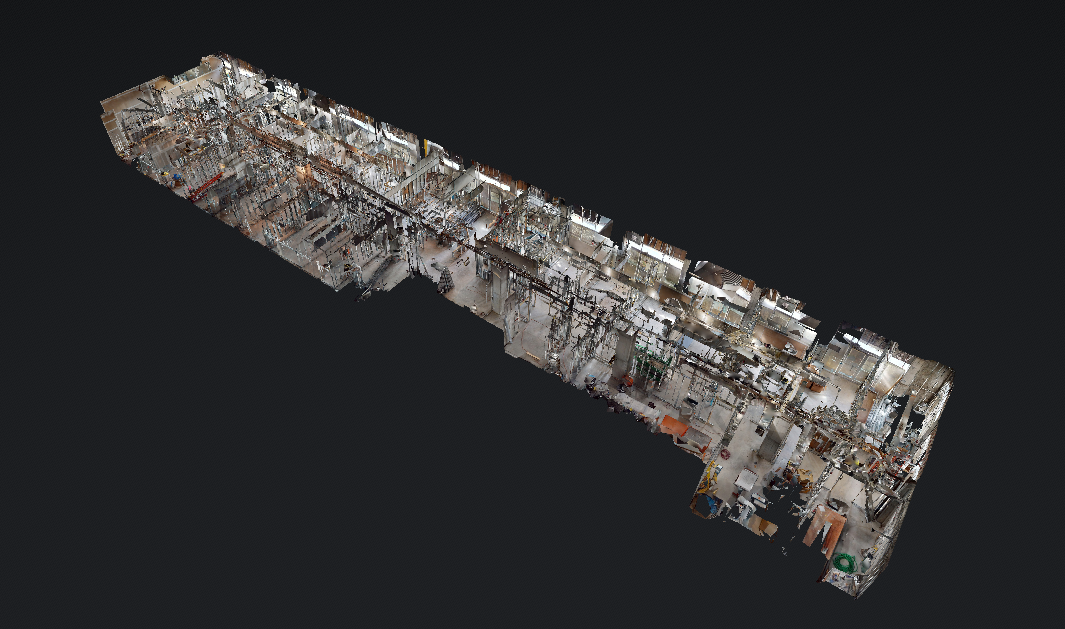
REGISTERED. VENDOR-NEUTRAL. BIM-READY.
POINT CLOUD & BIM
Registered E57 point clouds in the vendor-neutral ASTM E2807 standard, plus LOD 200 Revit models. Import directly into Revit, ReCap, Navisworks, AutoCAD, and Trimble — no conversion step, no re-measure.
Deliverables
- Registered E57 point cloud (ASTM E2807)
- LOD 200 Revit model (.RVT)
- Scan station positions and RGB data preserved
- High-density capture available for MEP, conduit, and pipe runs
Ideal for: Architects, MEP engineers, structural engineers, BIM managers
Get a Quote
TIMESTAMPED. DEFENSIBLE. ON THE RECORD.
PROGRESS & PRE-DEMO CAPTURE
A dated 3D record at every phase — before demo, before drywall, at closeout. When scope is disputed or a concealed condition surfaces, you settle it with a walkthrough instead of a claim.
Deliverables
- Phase-by-phase capture on your schedule
- Timestamped record of pre-existing conditions
- In-wall documentation of MEP routing before close-up
- Hosted archive with optional long-term retention
Ideal for: General contractors, project owners, investors, insurance adjusters
Get a QuoteHow It Works
FROM SITE TO DELIVERABLE IN 72 HOURS
Schedule
Contact us to schedule your site capture. We coordinate access, equipment, and crew for a seamless on-site visit.
Capture
Our team deploys LiDAR scanners and drone equipment on-site. Most captures complete in a single visit.
Process
Raw scan data is registered, cleaned, and processed into your chosen deliverable format in our Miami studio.
Deliver
Final deliverables are sent within 72 hours — ready for immediate use in your workflow.
READY TO CAPTURE YOUR SPACE?
Tell us about your project and we'll recommend the right solution — and get you a quote within 24 hours.